I drive between Sacramento and South Lake Tahoe all the time, and I take Highway 50 the whole way. It’s the easiest, cleanest route, and it’s the one that’s most likely to be open when the weather turns. You can do it in about two hours when the roads are clear and nobody else is on them. On a Friday afternoon it’s longer, and in winter it’s however long the mountain decides it’s going to be that day. Here’s what I’ve figured out after a lot of trips.
Which way: 50, 88, or 80?
Fifty is the answer for almost everybody. Sacramento, El Dorado Hills, Placerville, Pollock Pines, up and over Echo Summit, down into Meyers, and you’re in town. It’s the most direct way and Caltrans puts a lot of effort into keeping it open.
There’s another way that I really like if you have the time, which is Highway 88 over Carson Pass, past Kirkwood. It’s a lot longer, but it’s a beautiful drive, the kind of day where you roll the windows down and aren’t in a hurry. It takes you down through Jackson and then back up. If you’re coming from south of Sacramento, more the Modesto side, it makes a lot of sense, and from Sacramento it’s a nice change if you want the scenery. The catch is that 88 closes when it snows hard. Caltrans does try to keep it open year-round because of Kirkwood, but the Carson Spur gets shut for avalanche control and storms close it more often than 50, so I think of it as a summer and fall road unless I’ve checked it that morning.
Then there’s 80 to 89, coming around the west shore. I almost never take it to South Lake. If you’re starting in Roseville it might make sense; I’ve never actually tried it from there so I can’t tell you. Where 80 earns its keep is when 50 closes. It’s a longer loop, but it’s an interstate with its own plows, and sometimes it’s the only way in.
Where I stop
It depends on which direction I’m going and what time of day it is.
If I’m leaving Sacramento in the morning I grab coffee before I go, usually Old Soul or Temple. There’s nothing on the way up that beats them, so get it in town.
If we’re driving up in the evening, my wife and I got into a routine of picking up sushi at Mikuni in El Dorado Hills Town Center right before we leave the suburbs behind. It’s the last easy food before the mountain and it holds up fine in the car.
If you’re in an electric car, there are chargers right after Pollock Pines on 50, and they’re usually pretty empty. There’s a gas station right there too, so it’s a good spot to use the bathroom and stretch before the climb.
And coming back down toward Sacramento, I stop at Freel Perk in Meyers, right at the base of Echo Summit. Great coffee and a really good breakfast burrito. They’re open 6 AM to 6 PM, so it works whatever time you’re heading out.
When to leave on a Friday
Earlier than you want to. The thing about the Friday drive is that everyone in Sacramento leaves at the same time, and everyone in the Bay Area is right behind them, so the problem isn’t the distance, it’s the timing. Once rush hour starts and all those people are on 50 at once, the stretch through Placerville and then again coming into Meyers can get pretty gnarly, and it stays that way into the evening.
My rule is to be through El Dorado Hills by 3 o’clock, and earlier is better. If you’re coming from San Francisco, think of 3 as the time you want to be past Sacramento, not the time you leave the city. Do that and you’re over the summit while everybody who left at 5 is still sitting on the freeway.
When you get here
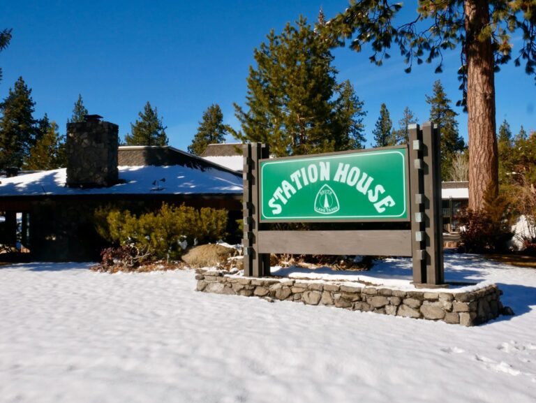
Check in at Station House, have a welcome drink, and walk a couple of minutes down to Lakeside Beach for the sunset. Toulouse, our restaurant, is right on the property for the night you don’t feel like getting back in the car. Guest parking is free.
Echo Summit when it’s snowing
First thing: if the road is open, we’re open. Second thing: from November on, you need four-wheel drive, all-wheel drive, or chains in the car. Not “I’ll pick some up if it looks bad,” actually in the car. Caltrans sets up chain control on the way up to Echo Summit, and if you don’t have what they’re requiring, you’re turning around at the checkpoint.
The longest I’ve personally waited at the summit is four or five hours. It happens. I’ve also been stuck trying to leave Tahoe because somebody spun out right at the top of the pass coming into South Lake. It’s just part of the deal up here in winter, and the people who handle it fine are the ones who were ready for it. So keep some things in the car: extra water, snacks, a warm blanket, a flashlight, gloves you can put chains on with, and chains you know fit your tires.
Practice putting the chains on before you need them
This is the best advice in this whole post. Before the season, on a dry day, put your chains on in your driveway. Take them off, do it again. My wife would sometimes make the drive up without me, so we made sure she could do it herself, and if you’ve got teenagers who are going to be driving up to snowboard, run through it with them too. You find out two things: whether the chains actually fit your tires, and whether you can get them on when your hands are cold. There are plenty of good YouTube videos for whatever chains you have. It’s a lot easier to learn in your driveway in October than on the side of the road in a snowstorm with a line of cars behind you and not much light.
What people from Sacramento get wrong
Honestly, two things. Everybody leaves at the same time, and that’s where the traffic comes from. And they underestimate the snow. A little snow isn’t a closure, and putting chains on isn’t a closure. It’s just winter. If you show up prepared, the mountain is a lot less dramatic than it looks on the weather app.
Your first night
Come check in. We’ll have a welcome beverage for you, you can use the bathroom, get more water, unpack, and kind of unwind from the drive. If you got here before sunset, walk down to Lakeside Beach. It’s a couple of minutes from our door, and watching the sun go down over the lake is a pretty good way to remember why you drove up.
For dinner on that first night I’d send you to Toulouse, our restaurant on the property. The food is great, the drinks are great, and you don’t have to get back in the car. If you’re rolling in late, it’s still the move, because it’s right here.
Quick facts
| Sacramento → South Lake Tahoe | |
|---|---|
| Best route | Highway 50 the whole way |
| Scenic option | Highway 88 over Carson Pass (closes in big storms) |
| Backup when 50 closes | I-80 to 89 |
| Friday cutoff | Through El Dorado Hills by 3 PM |
| Winter kit | Chains or 4WD/AWD, water, blanket, flashlight, gloves |
| Coffee down the hill | Freel Perk, Meyers, 6 AM–6 PM |
Before you leave, check road conditions on Caltrans QuickMap, or call the front desk and we’ll tell you what the summit looked like an hour ago. You can see our rooms and current offers here, or get in touch if there’s something I didn’t cover.
Highway 50 the whole way. It is the most direct road and the one most reliably kept open in winter. Highway 88 over Carson Pass is a longer, scenic alternative that closes during big storms and avalanche control.
About two hours on Highway 50 with clear roads and no traffic. Friday afternoons and winter storms add time, sometimes hours at Echo Summit during chain control.
Be through El Dorado Hills by 3 PM. Later than that you join the rush-hour wave, with slowdowns at Placerville and Meyers.
From November on, carry chains or drive a 4WD/AWD vehicle. Caltrans enforces chain control on the Echo Summit climb and turns back vehicles without the required equipment.
EV chargers and a gas station just past Pollock Pines on the way up; Freel Perk coffee shop in Meyers on the way down. Old Soul or Temple for coffee leaving Sacramento.
Check Caltrans QuickMap (roads.dot.ca.gov) before leaving. If Highway 50 is open, Station House Inn is open.